TECH Signal 324 4 feeds carried it
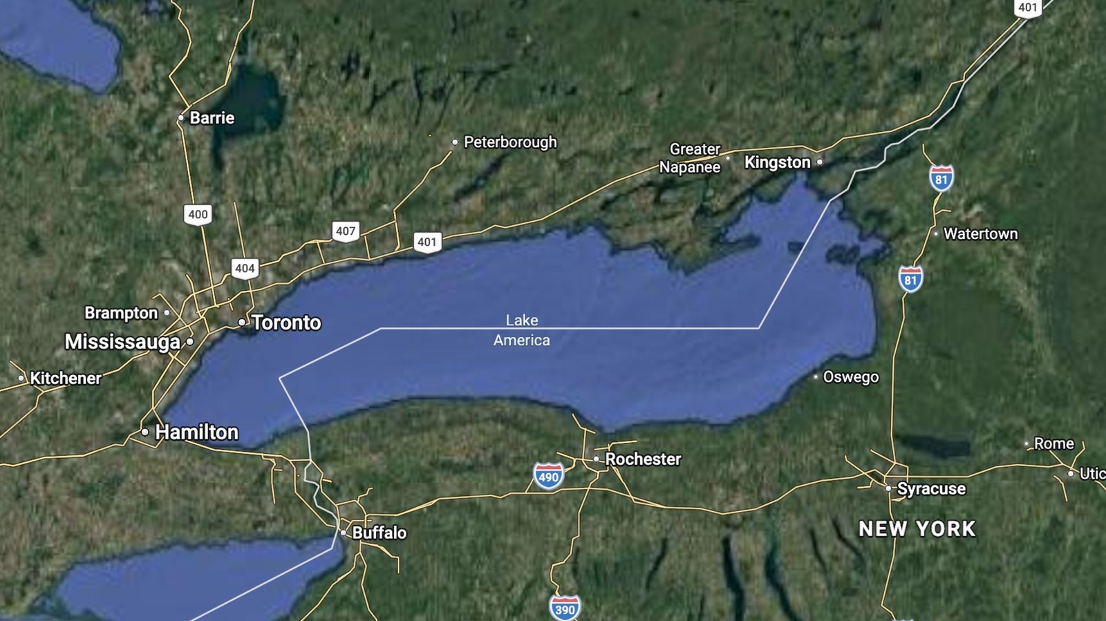
Google Maps shows "Lake America" instead of Lake Ontario for US users after GNIS name change
Google Maps now displays Lake Ontario as "Lake America" to US users following an official name change in the US Geographic Names Information System, while Canadian users continue to see "Lake Ontario."
This demonstrates how mapping platforms apply country-specific name changes based on official government sources, meaning the same body of water now carries different labels depending on the viewer's location. Engineers building location-aware applications on Google Maps data should expect similar divergence whenever geopolitical name changes occur.
Written by elseif from the cluster below · every claim links back to a sourceThe three things worth knowing
Google Maps applies name changes from official government sources per country, so US users see "Lake America" while Canadian users see "Lake Ontario."
The rename follows President Trump's executive order and a corresponding update to the US Geographic Names Information System (GNIS).
Users outside the US and Canada will see both names, following Google's long-standing policy for bodies of water with names that vary by country.
THE READ
What the cluster adds up to.
Google has relabeled Lake Ontario as "Lake America" for US users of Google Maps, following an executive order from President Trump and a corresponding formal change in the US Geographic Names Information System (GNIS). The company stated that it updates Maps to reflect name changes in official government sources, and in the US that source is GNIS. Canadian Maps users will still see "Lake Ontario," and users elsewhere will see both names displayed.
This is not the first time Google has applied this country-specific naming policy. The company provided a similar explanation when it switched the Gulf of Mexico label to "Gulf of America" for US users. Google described these updates as following its long-standing policy for bodies of water whose names vary from country to country, and said the changes are starting to roll out now.
Apple Maps has not yet made the update for Lake Ontario, though it adopted the Gulf of Mexico's new Trump-ordered name last year, suggesting it may follow suit. The divergence between platforms means that applications depending on different mapping providers could show different labels for the same geographic feature, at least temporarily.
For engineers working with Google Maps APIs or embedded map data, the practical consequence is that place name strings returned for US-based queries may now differ from those returned for Canadian or international queries for the same coordinates. Any application that compares, caches, or displays body-of-water names should account for the possibility that a single geographic feature can carry multiple valid labels depending on the user's location.
Written by elseif from the cluster below · checked for specifics the sources never containedTHE CLUSTER
↗