DATABASES Signal 142
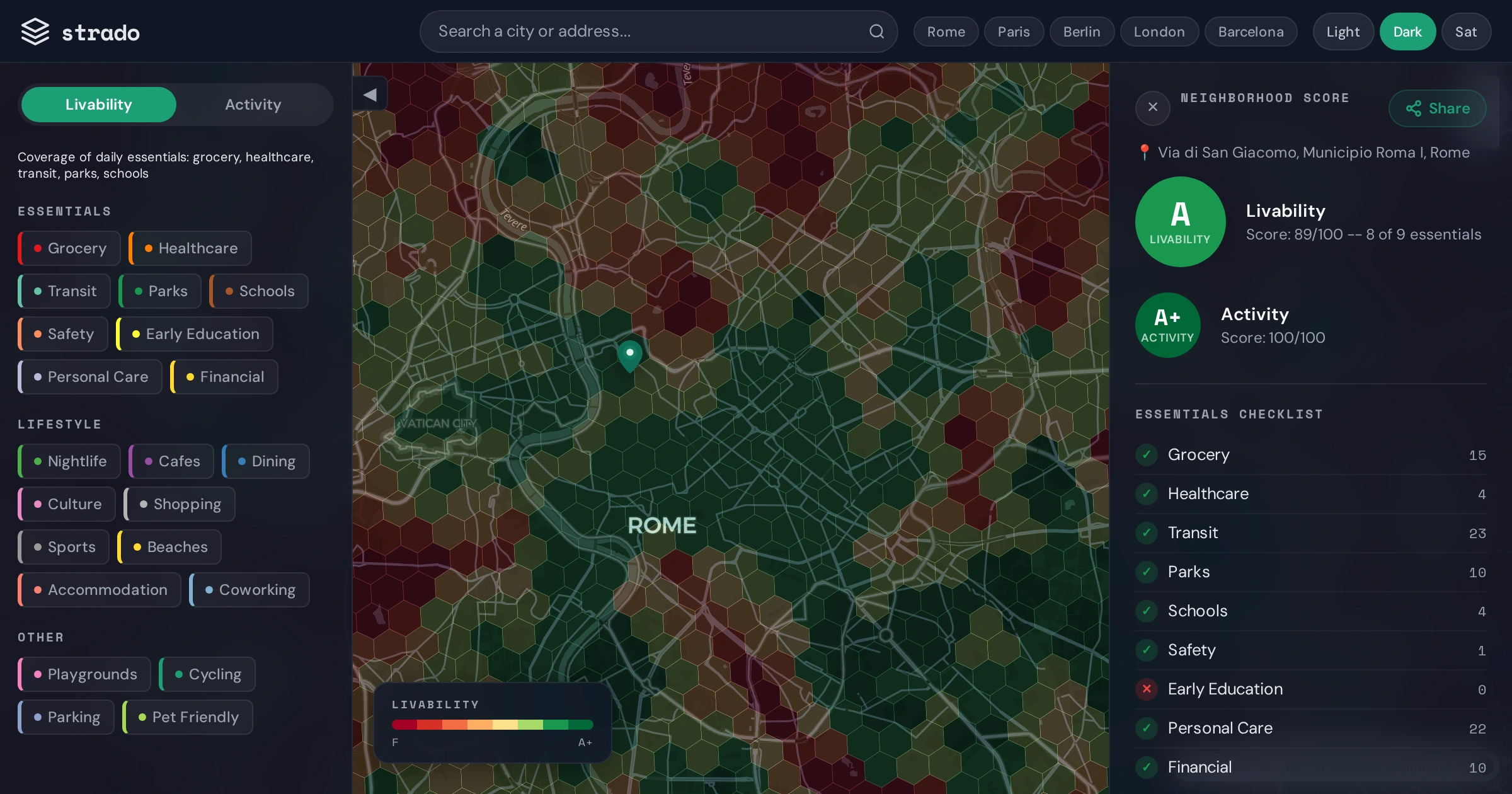
Open dataset scores 50 European cities on 22 walkability categories using OpenStreetMap data
 ↗
↗
Strado releases a free, open dataset quantifying what is accessible within a 10-minute walk across 50 European cities, using OpenStreetMap as its source.
Engineers building location-aware applications or urban planning tools now have a pre-computed, street-level dataset that removes the need to process raw OpenStreetMap data themselves. The dataset is limited to walkability metrics and does not include real-time or proprietary data layers.
Written by elseif from the cluster below · every claim links back to a sourceThe three things worth knowing
Dataset covers 50 European cities with 22 categories of walkable amenities per neighborhood.
All data is sourced from OpenStreetMap and is freely available without licensing restrictions.
Scores are computed at the street level, enabling fine-grained comparisons but not real-time updates.
THE READ
What the cluster adds up to.
Strado has compiled a dataset that quantifies walkability across 50 European cities by scoring neighborhoods on 22 categories, including shops, healthcare, transit, and parks. The data is derived entirely from OpenStreetMap, which means it inherits both the strengths and limitations of that source. For engineers, this eliminates the need to process raw OpenStreetMap data to extract walkability metrics, but it also means the dataset reflects the completeness and accuracy of OpenStreetMap at the time of processing.
The dataset is structured at the street level, allowing for granular comparisons between neighborhoods within the same city. This level of detail is useful for applications like relocation tools, urban planning, or local search services. However, the dataset does not include real-time data, so it cannot reflect temporary closures, new openings, or other dynamic changes. Engineers integrating this dataset must account for its static nature and plan for updates or supplementary data sources if real-time accuracy is required.
The dataset is openly available and free to use, which lowers the barrier for engineers to incorporate walkability metrics into their applications. This could be particularly valuable for startups or public sector projects with limited resources. However, the dataset is limited to walkability and does not include other factors like safety, noise levels, or cost of living, which may also be relevant for end users. Engineers will need to combine this dataset with others to build more comprehensive tools.
The scoring methodology is not fully detailed in the provided material, which may introduce uncertainty about how different categories are weighted or normalized. For example, a neighborhood with a high density of cafes but no grocery stores may receive a different score than one with the opposite profile. Engineers relying on these scores should validate them against real-world use cases or user feedback to ensure they align with the intended application.
Written by elseif from the cluster below · checked for specifics the sources never containedTHE CLUSTER