TECH Signal 506
Satellite images reveal heatwave-scorched Europe: shrunk glaciers, wildfires, low rivers
 ↗
↗
Copernicus Sentinel-2 satellite imagery shows western Europe’s landscapes altered by summer heatwaves, with shrunken glaciers, scorched fields, and reduced river levels.
Lower river levels have forced nuclear power stations to cut output or shut down because they cannot use river water for cooling. Agriculture faces stress as vegetation indices show widespread browning and soil moisture drops, threatening crop yields. Transport on rivers like the Rhine and Danube is disrupted, with cargo vessels stranded and cruises cancelled.
Written by elseif from the cluster below · every claim links back to a sourceThe three things worth knowing
Satellite data from Copernicus Sentinel-2 recorded shrunk Alpine glaciers, with the Rhône Glacier retreating by 50 m (160 ft) or more since the same time last year.
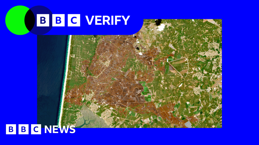
Wildfires burned over 90,000 hectares in France, the worst year on record, with the Gironde fire alone consuming about 42,000 hectares.
River levels on the Danube fell to their lowest in 30 years, affecting navigation and forcing nuclear plants to reduce or halt operations.
THE READ
What the cluster adds up to.
Satellite observations from the Copernicus Sentinel-2 mission have revealed a suite of landscape changes across western Europe following successive summer heatwaves. Glaciers in the Alps show measurable retreat, with the Rhône Glacier losing over 50 m of front length compared to the previous year. Vegetation has turned brown in large swaths of France, the UK and western Germany, as indicated by lowered Normalised Difference Vegetation Index values. River systems such as the Danube and Rhine have experienced markedly reduced water levels, exposing riverbeds and limiting navigability.
The energy sector feels direct consequences because nuclear power stations rely on river water for cooling. With river levels at their lowest in three decades, plants have been forced to shut down or operate at reduced capacity, which disrupts electricity supply and may increase reliance on alternative generation sources. These operational constraints translate into higher costs for utilities and potential market impacts, though the article does not quantify financial effects.
Agricultural productivity is at risk as satellite-derived NDVI readings fell below a five-year benchmark of 2021 to 2025 across about 70 % of France, and similar stress appears in the UK and Germany. Soil moisture measurements indicate conditions drier than on about 98 % of comparable historical dates, suggesting that crops are experiencing severe water stress. Persistent dryness could diminish yields and affect food production, prompting a need for adjusted irrigation strategies or crop selection.
River-based transport has also been impaired; cargo vessels on the Rhine have been left stranded and river cruises cancelled, while the Danube’s low water has uncovered historical artifacts such as a mammoth bone and a sunken WW2 warship. Satellite imagery provides valuable monitoring capability, but it cannot prevent the physical impacts of heatwaves, drought, or fire. Adaptation measures, such as alternative cooling for power plants, improved water management, and fire-mitigation practices, may be required, yet their effectiveness could diminish if heatwave frequency and intensity continue to rise under ongoing climate trends.
Written by elseif from the cluster below · checked for specifics the sources never containedTHE CLUSTER